
見通しの地図 / Map of View
2020. 11
drawing
design for a class / personal work
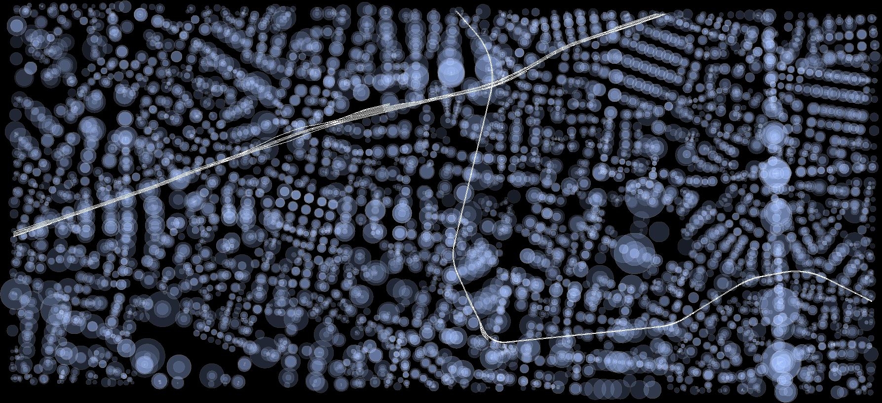
世田谷区などの東京の郊外はもともと田畑の広がる地域であったが、昭和初期に人口が急速に増えたことでスプロール現象が発生した。このため世田谷区の住宅街の道路は細くうねっていて、さまざまな小規模のグリッドがひしめき合っており、散歩をしていると見通しの良さや向きは刻一刻と変化していく。この街の形成過程を表象する見通し体験の多様さを直感的に伝える地図を考えた。
道の個々の交差点や屈曲部での見通しの距離や方向の種類を、同心円の径や数で表している。比較として計画的に街が作られた札幌についても同様のルールで見通しの地図を描いた。
Tokyo's suburbs such as Setagaya Ward were originally an area of sprawling fields, but the rapid increase in population during the Showa period (1926-1989) led to the urban sprawl. For this reason, the roads in Setagaya Ward's residential areas are narrow and undulating, and small-scale grids of various angles are crammed together. As one strolls through the area, the visibility and orientation change from moment to moment. I came up with a map that intuitively conveys the diversity of outlook experiences that represent the formation process of this city.
The type of sight distance and direction at individual intersections and bends in the road is represented by the diameter and number of concentric circles. As a comparison, I drew a map of view using the same rules for Sapporo, a city that was planned and built in a planned manner.

